Reconstructing the vegetation disturbance history of a biodiversity hotspot in central chile using Landsat, Bfast and Landtrendr

Sep 1, 2015·
Julián Cabezas Peña
Julián Cabezas Peña
,
Fabian E. Fassnacht
· 0 min read
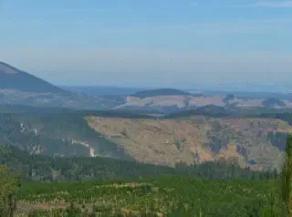
Vegetation disturbances are an everyday occurrence in the Maule Region, Chile.
Abstract
Due to its isolated location, Chile’s flora is characterized by a large number of endemic species which has guided the decision to assign central Chile the status of a global biodiversity hotspot. This biodiversity hotspot is, however, endangered by severe land-use changes occurring over the last few decades as well as by an increased number of invasive species, competing with native vegetation. Some of these invasive species benefit from or even depend on disturbance events for dispersal. Hence, a reliable reconstruction of vegetation disturbance is likely to be an important variable for explaining currently observed distribution patterns of invasive species. Here, we combine Landsat-based time series of three vegetation indices (NDVI, NDMI, NBR2) with the time-series-analysis algorithms BFAST and Landtrendr to reconstruct the disturbance history of central Chile for the time period between 1998 and 2015. First results led to overall accuracies of approximately 61-74% and 55-90% for BFAST (NBR2) and LandTrendr (NDVI), respectively. Results were notably influenced by the composition (disturbance types) of the reference data where clear-cuts were detected with notably higher accuracies than fires. The first results obtained by merging the results from several indices and both disturbance detection algorithms did not notably improve the performance but these experiments are still on-going. The obtained disturbance maps agree well with expected ecological processes with an increased number of disturbance events in the Western part of the study area which is dominated by forest industry and a reduced number of disturbances in the East where the complex terrain of the Andes mountains largely prevents industrial forest activities.
Type
Publication
IGARSS 2018 - 2018 IEEE International Geoscience and Remote Sensing Symposium. IEEE
publication
Julián Cabezas Peña
Authors
AI and the environment

I am a data scientist and Natural Resources Engineer from Universidad de Chile, with a Master of Data Science from the University of Adelaide. I combine artificial intelligence, data science, statistical analysis and geospatial analysis to tackle environmental challenges.

Since February 2022, I have coordinated the Data Science team at Chile’s Superintendence of the Environment (SMA). I develop automation, data validation and analytical solutions for environmental monitoring and enforcement, using R, Python and SQL.

My experience also includes computer vision and deep learning for agricultural robotics, forest carbon modelling, remote sensing and survey data analysis. I have worked in Chile, Australia and Germany, combining applied research, algorithm development and interdisciplinary team coordination.